
2017 – Year of Enhancements
GSI Distribution Design Studio is a comprehensive, modular solution that improves the design process by combining robust GIS/CAD rendering and editing capabilities with GPS and intuitive, efficient toolsets to streamline utility workflows, reduce design cycle times and share design information with internal and external systems (GIS, WMS).
2017 brings some exciting new enhancements coming to GSI’s Distribution Design Studio.
One of those enhancements will allow users of DDS to make use of various Web Services in the Plan View throughout the design process. DDS has long had the functionality to view GIS data sets along with importing and rendering multiple CAD file types for overhead and/or underground designs. This upcoming enhancements adds another important, accessible resource to the DDS accoutrement. GSI is exploring a number of different methods to make this visual a reality in DDS, starting with Open GeoSpatial Consortium web map services, web map tile services, and web map feature services. Additional ways of accessing this type of data may be possible, but they may also require subscriptions to gain that access (userid, password).
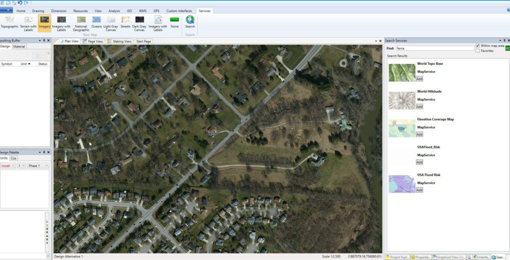
With the ability to connect to these types of services within DDS, users will have access to a wide variety of valuable data sets such as imagery, parcel data, parcel attributes, and other published layers (soils, basemaps, wind zones, floodzones, etc.). This provides a much easier mechanism for DDS users to interact with this type of data as opposed to importing individual image files. We think the usability increase and the use of on/off button accessibility of these data types has the potential to positively impact more users in more design scenarios. Using web services to view additional background resources will save designers time and potentially reduce trips to the field and other back and forth verifications common in design workflows. Consumers have grown accustomed to turning visuals (imagery, streets, trails, traffic, etc.) off and on when using various mapping applications on their phones and computers, so implementing a similar UI to DDS makes the most sense as we continue to expand on the most robust design tool in the market.

Look out for more enhancement to DDS in upcoming blogs through out the rest of 2017. If you are interested in learning more about enhancements or have other DDS questions or want to see a demo, please let us know… info@gsiworks.com